0800 436 723
Search Site
31 March 2013
Article from a blog by Valley Irrigation: growingtheconversation.blogspot.co.nz
From tractors and combines to irrigation systems, growers are using GPS to make the most of their land and make their jobs easier and less stressful. Today, precision farming is becoming the norm.
"With precision farming, growers are optimizing row spacing, accurately applying fertilizers, crop protection products and water, and being more productive with the land available to them," says Valley Product Manager Scott Mauseth. "Farming is really evolving."
Global positioning history began on the farm in the form of auto-steer tractors, which became available in the late 1990s with the growth of the GPS network. Auto-steer provides greater accuracy for strip-till and other precise techniques. Its use helps to alleviate exhaustion of the operator, allowing better monitoring of all the equipment involved for the task at hand.
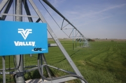
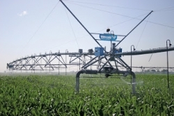
GPS helps growers make the most of their biggest asset - land
GPS makes Variable Rate Irrigation (VRI) possible. VRI technology gives farmers a more precise way to apply water and other crop inputs. With tools like soil maps and yield maps, growers can prescribe where the water should be applied to maximize production and make the most efficient use of the water resources being applied.
"GPS has also opened the potential to use corners and linear machines without burying wire," says Mauseth.
By choosing the GPS Guidance option, growers can make changes in their corner path with less expense and in significantly less time. Wire placed under structures or in planted fields is no longer an issue, and growers won’t waste precious time when the wires need repair or the path of the corner needs to be changed.
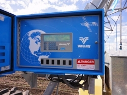
Mauseth explains that since GPS was already being used in nearly every new implement on the farm, it just made sense to incorporate it into irrigation. “Valley introduced GPS Ready control panels in September of 2008 and GPS Guidance for corners and linears in 2009.”
Pat Tolman, General Manager of Valmont Northwest, a dealership located in Pasco, Washington, says, “We have growers implementing GPS Positioning tools daily. It’s a relatively small cost to install on a new or current center pivot. It’s an easy upgrade that can result in a huge payback.”
Using the same GPS base that farmers are already using for their implements makes things pretty simple. Tolman explains, “Many growers already have a base, or they’re renting space from their local dealership. It’s very easy to find a base to use."
Valley utilizes two GPS choices available to growers. GPS Position with GPS Ready-Control panels utilize the Wide Area Augmentation System (WAAS) to pinpoint the position of your machine accurately. WAAS uses a network of ground-based reference stations throughout North America to measure and correct for small variations in the GPS satellites’ signals. Add-on GPS positioning packages are available for pivots and linears and require a GPS Ready control panel, like Pro2, Select2, or AutoPilot. The GPS position calculations are performed right in the control panel, a unique design feature in Valley control panels, so there is no need for an external processor.
GPS Guidance for Valley linears and corners is another Valley innovation. Growers can steer their corner or linear machines through the field utilizing GPS as the choice versus buried wire guidance. GPS Guidance allows growers to make the most of their GPS technology investment with compatibility to existing John Deere® Starfire™ or Trimble®. Navigation with these systems relies on Real Time Kinematic (RTK network) satellite navigation. RTK uses a single receiver as a base and rebroadcasts information to mobile units on the linear or corner machines. The base receiver uses measurements of the signal phases derived from the GPS satellites to gain greater accuracy.
GPS technology for center pivots, corners, and linear machines can bring a number of benefits to an operation. Growers will experience enhanced management capabilities and can take advantage of precision application techniques for water, fertilizer and crop inputs. This can lower input costs and ultimately can lead to higher yield potential – and greater profits.
Exactly how does GPS work, anyway?
The basic idea behind global positioning is triangulation, using a group of satellites to act as reference points in space. Calculations based on the known distance of the satellites above the earth and the time it takes for the signal to reach a receiver on or near the surface of the earth allow the system to accurately record the receiver’s location.
For more information on Valley GPS, contact your nearest WaterForce branch!
Copyright © 2015 - 2024 WaterForce. All rights reserved.
Terms & Conditions | Privacy Policy | Sitemap | Website design by KingSt | Powered by MOCA